City walls survey
37 Bishop's Bridge
|
|
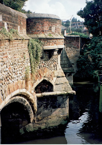
IntroductionThe Bishop's Bridge over the Wensum is east of the Cathedral at the end of Bishopgate. The Prior was granted a licence to build the bridge in 1275 [Blomefield page 62] and its construction seems to be the consequence of growing antagonism between the Abbey and the city. The bridge provided separate access to the precinct avoiding the city and also of course controlled the river and its trade down stream of the main wharves and quays above Whitefriars Bridge. The surviving stone bridge is said to date from about 1340. [Pevsner page 266] The work like much else for the completion of the defences was financed by Richard Spynk. 'He built the arches and the gate at Bishop's Bridge, so it appears that until this time it had only consisted of stone piers with a timber roadway.' [Hudson and Tingey 1910, volume 2, page xxxiii] The gatehouse was built over the river, set over the first arch of the bridge on the city side. It was a single square tower but with octagonal turrets at each angle, the whole with battlements. The gateway was demolished in October or November 1791 but the medieval stone bridge with massive stone piers and three arches spanning the river survives. [1] The bridge was not measured or recorded for this survey but a brief report is included here to pull together the main references and provide comparative material. |