City walls survey
8 St Augustine's Wall
|
|
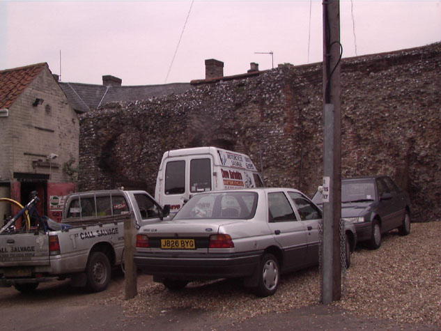
Conservation PlanThe present setting:The present setting of the wall is not good. It is hard pressed by buildings and yards on the north side and on the south side the land in front of the wall is divided between the small car park of the printing works and the yard of the motor cycle repair shop on St Augustine's Street. [14] The area on the eastern part, used as a car park, has recently been covered with gravel which is an improvement as it was just bare earth. At the west end a narrow alley way, less than a metre wide, provides access into the yards of the 19th-century terraced houses and shops on St Augustine's Street and Magpie Road. Potential medium or long-term improvements recommended for the surroundings:No opportunity for improvement can be envisaged. Archaeological impact assessment:It seems unlikely that there will be any opportunity for archaeological investigation in this section. At most an attempt should be made to arrange access with the owner of the printing works to undertake a survey of what remains of the tower. CONSERVATION REPORT SUMMARY WITH RECOMMENDATIONS FOR ACTION
BIBLIOGRAPHY:Blyth, G.K., The Norwich Guide and Directory (London: R. Hastings; DOCUMENTARY REFERENCES:No specific references. ARCHAEOLOGICAL REPORTS:Gressen Hall file 384, containing finds details and plans of site areaSMR NF26451 HISTORIC ILLUSTRATIONS IN THE DATA BASE:Norwich Castle Museum and Art GalleryKirkpatrick, John, c. 1720, `Tower from Magdalen Gates to St. Augustine's Gates and Houses by St. Augustine's Gates', NCM 1894.76.1689:INT Kirkpatrick, John, c. 1720 `Various Gates and Houses', NCM 1894.76.1686:INT |