City walls survey
17 St Benedict's Gate
|
|
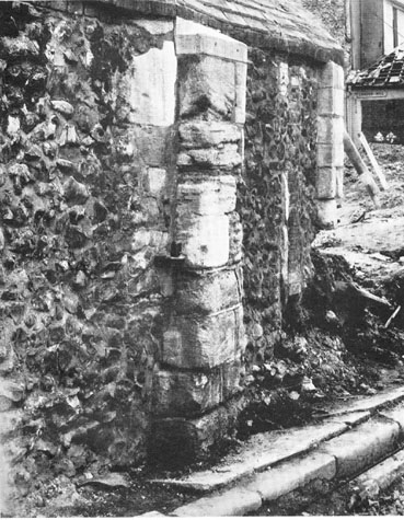
IntroductionSt Benedict's Gate was on the west side of the city, on relatively low ground on the road leading out towards King's Lynn. It was also known as the 'Porta de Westwyk in 1118/19 (18 Henry I) as St. Bennet's in 1160 and as Westwyk Gate. [Fitch, page 17] The medieval truncation of the name was St Bennet's. The gate was rebuilt in the 14th century under the auspices of Richard Spynk, citizen of Norwich. [Extract from The Old Free Book, Hudson & Tingey, vol. II,pages 216-22] Blomefield's transcription of the last leaf of the Book of Customs states that 'on that gate and wicket [were] 16 battlements.' [Blomefield, page 98] He notes also that by 1460 there were 4 soldiers on guard there. [Blomefield, page 163] The gate was unique among those around the walls for it had a square crenellated stair turret built against the west side that rose above the gate itself to provide access to the roof. The gate was taken down in 1793 though the south side of the gateway, incorporated into the side of a house built against the gate in the 18th century, survived until the 1940s when it was severely damaged by bombing in this area. [1] |