City walls survey
34 Wall West of King Street
 [14] View of the exterior of the wall from the south west looking towards King Street.
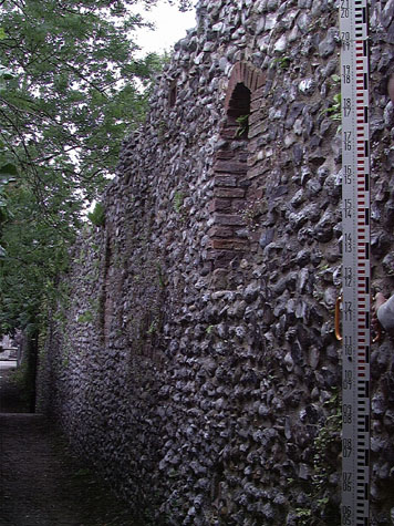
[15] The inner side of the wall from the east, from King Street.
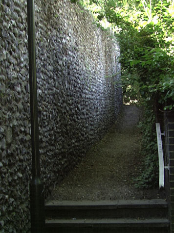
[16] The inner or north side of the wall from the west, looking towards King Street. |
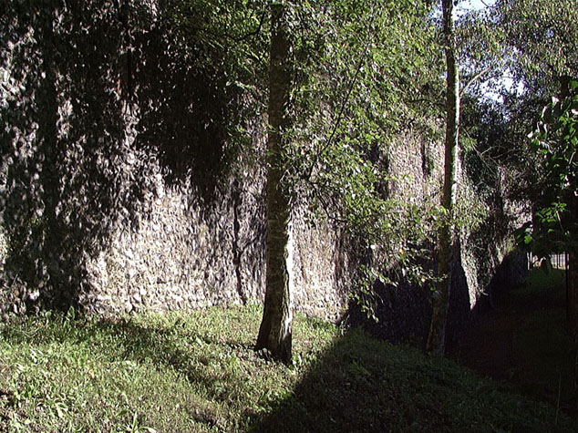
Conservation PlanThe present setting:On the outer or south side of the wall the site is now occupied by a residential home for deaf people. The building is of a high quality and has pleasant grounds set out around it incorporating several short terraces of earlier houses. The main building is too close to the wall and as a consequence the garden against the wall is dark and damp receiving little sun light. This is a problem that cannot now be remedied. [14] On the north side of the wall is a narrow pathway overhung with trees and bushes and on the north side of the path is an empty plot facing on to King Street that is much overgrown. [15 & 16] At the west end of the wall the ground opens out into the area of steep wooded hillside on either side of the lower tower. A footpath with steep timber steps divides and climbs up either, against the inner side of the lower tower and wall, to the Black Tower or follows the line of the outer ditch up to Carrow Hill. Potential medium or long-term improvements recommended for the surroundings:The imminent redevelopment of the Coleman's factory site on the east side of King Street provides an important opportunity to clear the outer side of the section of wall running down from King Street to the river and the west Boom Tower. That work should be planned in conjunction with a broader scheme to enhance the setting of the wall on the west side of King Street. The costs of much of the work could be modest ... immediate improvements could be made by careful cutting back of the under growth and lower branches of trees to raise the canopy clear of the wall. The steep narrow footpath on the north side of the wall is actually very attractive and is well used by walkers, local people cutting down to King Street from Bracondale and Carrow Hill and joggers. The aim should not be to produce a clinical manicured setting but undergrowth should be vigorously controlled to maintain sight lines over the river valley and views up to the walls and towers from the river and from the road. The most serious problem in this area comes perhaps from the very heavy traffic now using the steep narrow south end of King Street and the Carrow Road Bridge to move across the south side of the city. Any scheme to improve the setting of the wall on either side of King Street is dependent upon a much wider policy plan by the City Council for the future development of both the Coleman's site and the development of property along King Street within the city walls. Those plans are obviously outside the remit of this report. Archaeological impact assessment:Archaeological investigation in this area is not a priority. Presumably evidence was lost when the ground to the south of the wall was lowered and when the level of King Street over the site of the gate was taken down to its present level. Conservation Report Summary with Recommendations for ActionImmediate attention
Requires regular monitoring
Long term conservation
Long term improvements to the setting
BIBLIOGRAPHY:Collins, Arthur E., The Walls of Norwich (City and County of Norwich, DOCUMENTARY REFERENCES:N.R.O. MF/RO 29/3 f. 177 (Liber Albus) ARCHAEOLOGICAL REPORTS:Included in the 1970 report - see appendix HISTORIC ILLUSTRATIONS:Hepworth, Philip, Norwich in Old Picture Postcards (Netherlands: European Norwich Castle Museum and Art Gallery: |