City walls survey
38 Cow Tower
|
|
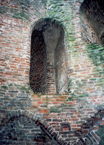
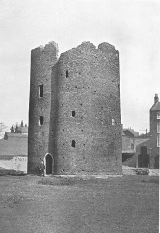
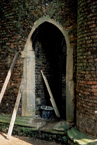
General descriptionThe tower is just over 15 metres high with an external diameter of 11 metres. This is marginally larger than the Black Tower [Report 32] which rises 13.5 metres on the outer side and is 9.6 metres across. There is a projecting stair turret on the west side with a spiral stair that turns anti clockwise with brick treads and a stone newel. [2 & 3] It serves rooms on three floors in the tower and presumably continued to the roof. A photograph published in the 1910 report shows the tower was then entered by a narrow arched doorway at the base of the stair turret on the south side. [4] The doorway is now on the north side of the stair turret. [5] There is evidence that the ground floor was vaulted. There are deep embrasures through the wall on all levels with arched loops or stone cross-shaped loops on the outer face. [6 & 7] Doorways are in brick with simple chamfered jambs and arched heads. The chambers are heated by substantial fireplaces. There are nine levels of putlogs visible on the exterior. [8 & 9] The tower was recently restored and is in good condition. Documentary evidence:The Chamberlain's Accounts for 1398-99 contain a complete transcription and translation of expenses paid for the upkeep of the tower during these years, the total of which came to �36 17s 2d. [N.R.O. case 7a and b: Ayers, Smith & Tillyard, pages 202-206] In the Agistment for the Walls in 1451 and 1481, East Wymer Ward were responsible for repairs to 'the toure with the dongeon by the Hospitall medewes on the north est corner. [Liber Albus, f. 177; Hudson & Tingey, vol. II, pages 313-15] Map evidence:The tower is shown on the Sanctuary Map of 1541. [10] BIBLIOGRAPHY:Ayers, Brian S., Smith, Robert, & Tillyard, Margot, 'The Cow Tower, See also: DOCUMENTARY REFERENCES:N.R.O. Case 7a and b (Chamberlain's Accounts for 1398-99) HISTORIC VIEWS:Geldart, Joseph. Undated charcoal sketch of the tower shows it in |