City walls survey
6 Magdalen Street Wall
|
|
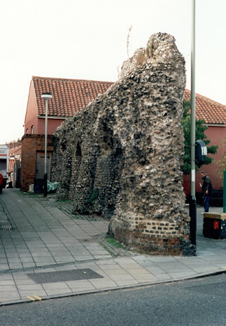
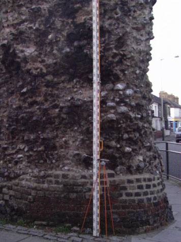
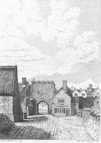
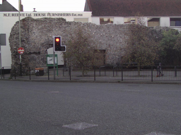
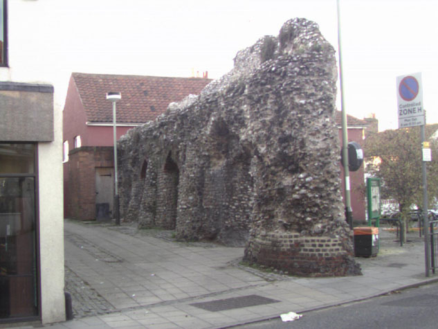
IntroductionThis section of the wall is just 17 metres long with the remains of three arches on the inner side that supported the wall walk. [1] A public toilet at the west end is built over the position of a fourth arch. The wall stands to a maximum height of 5.3 metres. There is clear evidence for the level of the wall walk and a small part of the narrow outer parapet survives. With a parapet, the top of the wall would have been about 2 metres higher than the wall walk with merlons and embrasures forming widely-spaced crenellations. The wall is at the junction of Magdalen Street and Magpie Road, immediately west of Magdalen Street and the site of the main north gate into the city. The outer side of the wall faces north. The present level of the road over the site of the gate is lower than the medieval level and the lower part of the wall at the east end was revealed and under built with brick to support and strengthen the corner when the road was lowered. [2] On the city side of the wall, the ground rises quickly and this higher level seems to respect the line of the medieval lane inside the wall. This section of the ditch on the north side of the wall was filled in by the late 18th century. A view of the gate from outside the city drawn by John Ninham shortly before the gate was demolished in 1808, [3] shows houses against the wall on both sides of the gate. [published by Robert Fitch in 1861, opposite page 27] In that view the crenellated parapet of this wall can be seen beyond the house abutting the gate on the west side. Against the gate on the west side is shown a steeply sloping roof that covered the steps that led down onto the wall walk from the upper chamber of the gate. The view also appears to show the gateway inserted through the wall that is now blocked. In the 19th century there was a public house called the White Swan against the north side of the wall over the line of the outer ditch. When that building was demolished, the outside face of the wall was badly damaged. [4] Historic maps indicate that there have never been buildings against the inner side of the wall. The arches of the arcade are nevertheless badly damaged with much of the brickwork broken away. At several different times the overhanging masonry of the arches have been supported by building piers of new flint work which have been rounded off to distinguish the work from the primary build. [5] Immediately beyond the wall on the north side or the outer ditch side is a 19th-century building with its south gable on the line of the wall. Evidence from historic maps suggests that this may be the site of the first tower on the Magpie Road section between Magdalen Gate and St Augustine's Gate. The tower was presumably close to the gate to provide cross fire to protect the side of the gate and the bridge or causeway over the ditch in front of the gate. [View of the wall 06-07 3D from SE] The wall was extensively restored in 1999/2000 and large areas of the outer wall were re-pointed. |