City walls survey
10 St Martin at Oak Wall Lane
IntroductionReport
Conservation Plan
Photographs
|
|
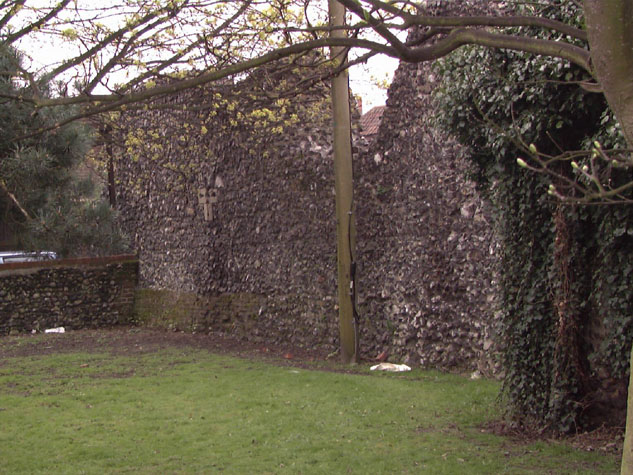
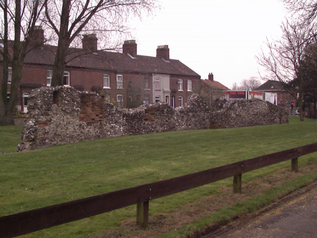
Conservation PlanThe present setting:The area is relatively quiet and is not a part of the city visited by tourists. The wall is set well back from St Augustine's Street which is relatively busy and is hidden by shops and houses on the street frontage. Bakers Road is a residential street with Edwardian terraced houses on the north side. Houses on the south side of Bakers Road, backing onto the walls, have all been demolished and the area is now a broad attractive grassed area with a good planting of specimen trees. [16] On the south side of the wall is a narrow lane with a tight difficult entrance from St Augustine's Street so it is little used except by local people. The area in front of the main part of the wall is an unsurfaced parking area. Between the main part of the wall and the lower section to the west is a brick-built electricity sub station within a walled and fenced enclosure. The building is of reasonable quality with a pitched roof and does not seriously detract from the appreciation of the walls. Beyond the sub station, the low section of wall has a broad grass verge on the lane side with a low wood fence to stop cars parking here. [17] Potential medium or long-term improvements recommended for the surroundings:This is one part of the city wall were the outer ditch could be re-established at least for part of the length. The technical problems of ensuring that the ditch drained and remained dry would have to be resolved. Perhaps a water filled ditch might be considered. Excavating the ditch should also reveal much more of the north face of the wall particularly at the west end of the section. Some trees on the north edge of the ditch could be retained. Trees at the east end should be thinned and the canopy raised to reveal more of the wall. Lighting of the wall at the east end should be considered. A low retaining wall 800mm high and set in front of the arches by about a metre should be constructed to reinstate the medieval ground level of the top of the bank. This would return the arches to their original proportions and would protect the base of the wall and the face of the wall from damage as cars manoeuvre in the parking area. The wall here faces south and the area could be turned into an attractive area with seating and low level planting though some local people and people working in nearby shops would resent the loss of a free parking area. Archaeological impact assessment:If funds should be available for archaeological work here there are several important areas where digs may reveal much, particularly if the ditch is in part reinstated.
CONSERVATION REPORT SUMMARY WITH RECOMMENDATIONS FOR ACTION
BIBLIOGRAPHY:Collins, Arthur E., The Walls of Norwich (City and County of
Norwich, DOCUMENTARY REFERENCES:No medieval documents specifically for this section |