City walls survey
13 Oak Street Tower
|
|
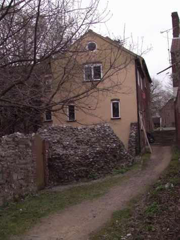
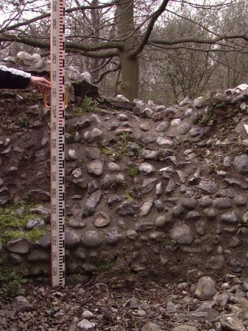
IntroductionSt Martin's Gate at the north-west corner of the defences was on the road into Norwich from Fakenham. It was set just above the River Wensum at the point where it flows into the city. In the Middle Ages, the river here was probably relatively wide and marshy and the road kept to a ridge on the east bank. There was a short length of wall running down from the gate to the river to close this section of the defences with a single round tower here, which was originally on the river bank. The water courses have changed since the Middle Ages and as the river has been constricted into a tighter channel, the tower is now set back over 40 metres from the river. [1] The tower was 15 metres from the site of the gate and 3 metres lower than the level of the road. [survey drawing 13-01 Map]. Only the base of the tower survives. The base is circular, with an external diameter of 6.2 metres and the surviving part stands to about 2.4 metres above the present ground level. Most of the flint of the wall face has been lost and there are no surviving features apart from what appears to be the remains of a loop on the north-east side which would have looked back along the outer face of the wall towards St Martin's Gate. [2] There is some indication that the internal floor level of a lower chamber survives in part and is just above the present ground level. A drawing in the Castle Museum dating from the middle of the 19th century is identified as a view of this tower and at that stage part of the vaulting of the lower stage survived. There is no indication from documents or maps of the original height of the tower ... it is not known if the tower had an upper chamber or just an open platform at the level of the wall walk protected by a parapet. Nor is there any evidence in the base of the tower for a staircase. The upper level of the tower could have been reached from the wall walk itself rather than from a staircase or steps here. Part of the wall between the tower and the gate survives in the basement of the house facing on to Oak Street. [survey drawing 13-02 Plan]. The house was built on the outer side of the wall beside the site of the gate and was the Dun Cow Public House in the 19th century.
|