City walls survey
22 Chapelfield Park (Tower and Wall)
|
|
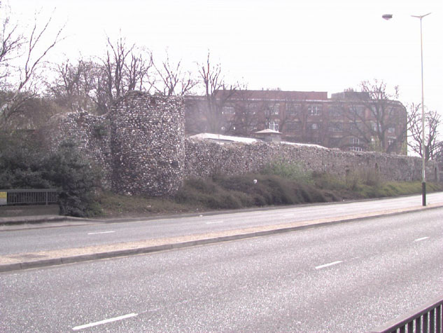
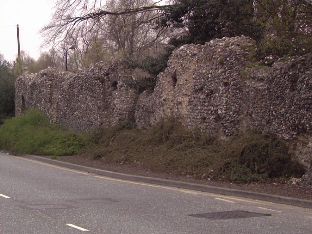
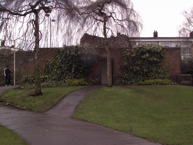
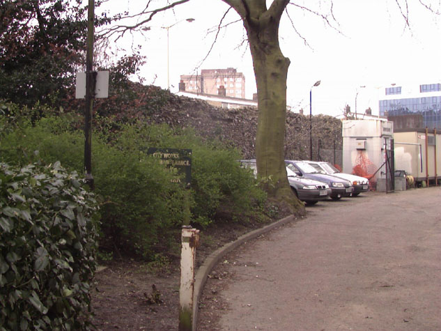
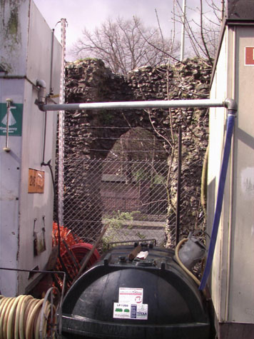
Conservation PlanThe present setting:The surviving section of wall is on the west side of Chapel Field Gardens but the setting is actually not very appropriate or very attractive. [22 & 23] As with the Coburg Street section to the south, the wall is hard against the dual carriageway of the inner ring road that is built over the line of the outer ditch. The road has heavy and fast moving traffic and there is no pedestrian access close to the outer face of the wall. The wall can only be seen from the pavement on the opposite side of the road. The narrow verge between the kerb of the road and the base of the wall is at most 4.4 metres wide and that is only for a short section at the north end near the tower. At the centre of the wall the verge is 1.3 metres wide and at the very south end it is just 400mm from the wall to the tarmac. [24] The verge is densely planted with a mixed planting of shrubs and although this forms a dense green base to the wall there are two problems. The greenery actually looks dry and very dirty because of road pollution and it grows too high, obscuring almost half the height of the wall at the north end though it is slightly lower at the south part. Because the greenery is dense, litter does not appear to be an obvious problem but the setting certainly does not do the monument justice. The wall has lost a third or more of its height anyway with the loss of the parapet and the length of the wall also has the visual effect of reducing the visual impact of its height. The soil level has also risen as the road has a high concrete kerb. The soil must be kept down and either dwarf varieties or low spreading varieties should be planted or shrubs should be trimmed regularly to reduce the base line greenery. The medieval setting and one that was contrived deliberately to maximise the impact of the wall was that not only was the wall 6 metres high but it was set at the top of the bank of the moat that was probably 5 metres high itself. In addition it would have been seen from open fields with few hedges and certainly no buildings to diminish the impact. It was and it looked impressive. The setting for the inner side of the wall is, surprisingly, bad. Only the north end of the wall can be seen from the park and even then all most people see is an impression of a glimpse of flint around the public toilets as they walk down into the underpass. [25] Few people probably even realise that the toilet is set within a medieval tower. The middle part of the wall is hidden by a large modern building of a nursery school. Not only does the single building hide the wall but it is set up very close to the wall and given the security now necessary around schools and school children there can be little or no access to the school enclosure to look at the walls. At the south end the main footpath on the west side of the park is 22 metres away from the wall and runs parallel to it. There is a dense high hedge bordering the path and the space between is now occupied by a depot for the works department that maintains the city landscapes. [26] There is a yard area enclosed by chain link fences and a number of 'temporary' huts against the wall and completely obscuring it. [27] Even south of the depot, the wall is still hidden but here by a very dense planting of trees and bushes. Potential medium or long-term improvements recommended for the surroundings:Although the setting of the medieval wall is inappropriate, only the vibration of fast moving heavy traffic is actually detrimental to the structure. However, a scheme of enhancement which may take a number of years to implement would improve the setting of the wall and make it easier for people to appreciate the monument.
Archaeological impact assessment:There may be evidence in this area for the bank and palisade and ditch that probably existed before the wall was rebuilt in flint. Further archaeological investigation or any watching brief for trenches cut for services should, if possible, focus on resolving if there was or was not an arcade on the inner side. The balance of existing evidence suggests not but archaeological evidence could prove or disprove the theory. Any work near the tower should be aware that the construction of the tower may not be contemporary with the building of the flint wall. It is not clear if the tower was always open to the inner side. Any work at the south end should be looking for evidence for the position, form, and date of construction and date of demolition for the lost tower. This would be particularly important if a new more steeply sloping access road is created for the redevelopment of the Nestle site. Conservation Report Summary with Recommendations for ActionImmediate attention
Requires regular monitoring
Long term conservation
Improvements to the settingPriority
Long termRe-site works depot, remove cabins and integrate area within main park Close gateways in wall with fixed full-height railings. Light tower both inside and out BIBLIOGRAPHY:Blomefield, Francis, An Essay Towards the Topographical History of the DOCUMENTARY REFERENCES:N.R.O. Book of Customs ARCHAEOLOGICAL REPORTS:Department of the Environment Report HSD9/2/1005pt6 (in) Gressen Hallfile 384 Plans for Chapelfield Road City Wall in Gressen Hall file 384 NAU Report 227, 'Former Nestle Site, Norwich' (Kenneth Penn, 1997) NAU Report 428, 'The French Borough at Norwich: St Stephen's Parish (west part)' (Kenneth Penn, 1999)
SMR NF206 HISTORIC ILLUSTRATIONS:Norwich Castle Museum and Art Gallery:
'Interior of Tower Chapelfields April 1835 I.W.', NCM Vol. D 141 DC. P. 3 |